bloggggg

Home  |  Live  |  Science  |  Lifestyle  |  Entertainment  |  Broadcast  |  Games  |  eBooks  |  Astounds  |  Adbite  |  Cricbell  |  Cyber  |  Idea  |  Digital  |  Privacy  |  Publish  |  ePaper  |  Contact  .Subscribe.Subscribe.Subscribe.Subscribe.Subscribe.Subscribe.Subscribe.Subscribe.Subscribe
Subscribe

Monday, 7 April 2025

Ofcom wants UK to be ‘first in Europe’ to use direct-to-device satellite services

The regulator is proposing that direct-to-device (D2D) satellite services make use of spectrum already licenced by mobile operators for 4G and 5G

This week, UK telecoms regulator Ofcom has proposed new rules that would allow D2D satellite services to be provided using the same spectrum and terrestrial mobile networks.

The regulator says the rules would make the UK the ‘first country in Europe’ to adopt such an approach, giving the nation a lead in this emerging technology.

“For years, we’ve seen satellite calls in disaster movies on special handsets. We’re now on the cusp of people being able to make them on their everyday smartphones,” said Ofcom’s Spectrum Group Director David Willis. “Ofcom always strives to be at the forefront of technological change, and we’re the first country in Europe to press ahead with the next frontier in mobile connectivity. This would unlock investment, open doors to innovation and growth, and bring much-needed mobile coverage to rural areas.”

D2D satellite communication has been a growing topic of interest for a number of years now, with the technology potentially allowing mobile operators to ensure their customers remain connected wherever they go.

Currently, satellite communications typically require a satellite to connect to a terminal deployed by the end user, which then relays the signal to the end user’s device, or to a specialised satellite phone. D2D services do away with this middleman, allowing customers to connect directly to the satellite itself using an unmodified smartphone.

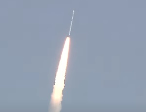
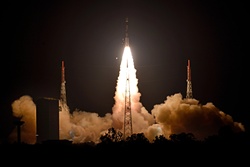
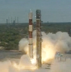
Elon Musk’s satellite behemoth Starlink is currently testing its D2D capabilities with T-Mobile in the USA, while other players like AST SpaceMobile are also advancing their capabilities. Just last week AST sought permission to launch the latest model of its BlueBird satellite, with the aim of launching commercial D2D services in 2026.

From a regulatory standpoint, however, these emergent services raise a question over spectrum usage. Current mobile spectrum licences for 4G and 5G do not provision for connection to satellites (at least in the UK) and doing so poses the risk of interference of existing mobile services.

Despite these technical challenges, allowing operators to make use of their existing spectrum licences is very attractive, potentially allowing them to roll out D2D services more quickly and efficiently. It could also potentially help them to reach their rural coverage obligations, in some instances.

Ofcom is suggesting three possible approaches to D2D satellite services: (i) a licence exemption; (ii) a variation to the MNO’s existing base station licence accompanied by a licence exemption; or (iii) a new licensing regime. The regulator says its preference is for option (ii) but is seeking comment from the wider industry.The consultation will continue until 20th May 2025, with commercial D2D services potentially becoming available later this year if the proposals are approved. Ofcom wants UK to be ‘first in Europe’ to use direct-to-device satellite services | Total Telecom

Monday, 24 June 2024

S. Korea to develop LEO satellite communications system by 2030

Seoul, (IANS) South Korea's Ministry of Science and ICT on Thursday said its project to develop a low Earth orbit (LEO) satellite communications system has passed a preliminary feasibility study and will officially begin next year.

The science ministry said that the 320 billion won ($234.3 million) LEO project, also known as South Korea's Starlink, aims to launch two LEO satellites based on the sixth-generation (6G) communications network technology by 2030, Yonhap news agency reported.

The ministry also plans to create a demonstration LEO satellite communications system network to support South Korean companies to independently develop core technologies for the system, such as satellite tracking, handover and link, and help them expand their global business.

As the project has passed the government's preliminary feasibility study, the ministry said it is allowed to allocate its budget from next year and start the project.

An LEO satellite, placed in an orbit 300 to 1,500 km in altitude, can provide high-speed communications with short latency thanks to its close distance to Earth compared with geostationary orbit satellites.

The 3rd Generation Partnership Project (3GPP), a global mobile telecommunication standards organisation, is also working to standardize the LEO satellite communications technologies as they have gained the spotlight as a non-terrestrial network, which can cover even remote areas without geographical limits.

Many global tech firms, including the US SpaceX and Amazon, have launched LEO satellite services in a bid to secure an early dominance of this highly advanced market.

SpaceX's Starlink, for instance, uses a swarm of LEO satellites to create a global broadband network.

The science ministry urged Korean companies to prepare to enter the 6G-based LEO satellite communications market considering the market is expected to begin booming in the 2030s after the 6G standardization is completed by 2029."We wish to give a fresh boost to the country's digital and space economy by bolstering our competitiveness in the satellite communications industry," Ryu Je-myung, head of the network policy department at the science ministry, said. S. Korea to develop LEO satellite communications system by 2030 | MorungExpress | morungexpress.com

Monday, 27 May 2024

S. Korea to develop LEO satellite communications system by 2030

Seoul, May 23 (IANS) South Korea's Ministry of Science and ICT on Thursday said its project to develop a low Earth orbit (LEO) satellite communications system has passed a preliminary feasibility study and will officially begin next year.

The science ministry said that the 320 billion won ($234.3 million) LEO project, also known as South Korea's Starlink, aims to launch two LEO satellites based on the sixth-generation (6G) communications network technology by 2030, Yonhap news agency reported.

The ministry also plans to create a demonstration LEO satellite communications system network to support South Korean companies to independently develop core technologies for the system, such as satellite tracking, handover and link, and help them expand their global business.

As the project has passed the government's preliminary feasibility study, the ministry said it is allowed to allocate its budget from next year and start the project.

An LEO satellite, placed in an orbit 300 to 1,500 km in altitude, can provide high-speed communications with short latency thanks to its close distance to Earth compared with geostationary orbit satellites.

The 3rd Generation Partnership Project (3GPP), a global mobile telecommunication standards organisation, is also working to standardize the LEO satellite communications technologies as they have gained the spotlight as a non-terrestrial network, which can cover even remote areas without geographical limits.

Many global tech firms, including the US SpaceX and Amazon, have launched LEO satellite services in a bid to secure an early dominance of this highly advanced market.

SpaceX's Starlink, for instance, uses a swarm of LEO satellites to create a global broadband network.

The science ministry urged Korean companies to prepare to enter the 6G-based LEO satellite communications market considering the market is expected to begin booming in the 2030s after the 6G standardization is completed by 2029."We wish to give a fresh boost to the country's digital and space economy by bolstering our competitiveness in the satellite communications industry," Ryu Je-myung, head of the network policy department at the science ministry, said. S. Korea to develop LEO satellite communications system by 2030 | MorungExpress | morungexpress.com

Tuesday, 14 February 2023

Isro's SSLV-D2 mission successfully places EOS-07 and 2 other satellites into orbit

Indian Space Research Organisation (Isro) on Friday successfully launched the second developmental flight of its Small Satellite Launch Vehicle (SSLV-D2) launching EOS-07, Janus-1 and AzaadiSAT-2 satellites into 450 km circular orbit, in its 15 minutes flight.
SSLV-D2, a 34 metre tall, 2 metre diameter vehicle having a lift-off mass of 120 tonne lift-off mass, lifted off from the first launch pad at SDSC SHAR, Sriharikota at 09:18 hours IST on 10 February with the three satellites and completed the mission in the scheduled 15 minutes.
EOS-07 is 156.3 kg satellite designed, developed and realised by ISRO. New experiments include mm-Wave Humidity Sounder and Spectrum Monitoring Payload. Janus-1, a 10.2 kg satellite belongs to ANTARIS, USA. A 8.7 kg satellite AzaadiSAT-2 is a combined effort of about 750 girl students across India guided by Space Kidz India, Chennai.
SSLV caters to the launch of up to 500 kg satellites to Low Earth Orbits on ‘launch-on-demand’ basis. It provides low-cost access to Space, offers low turn-around time and flexibility in accommodating multiple satellites, and demands minimal launch infrastructure. It is configured with three solid propulsion stages and a velocity terminal module.
SSLV is the new small satellite launch vehicle developed by Isro to cater to the launch of small satellites up to 500 kg to Low Earth Orbits on ‘launch-on-demand’ basis. It is configured with three solid stages 87 tonne, 7.7 ttonne and 4.5 tonne, respectively. SSLV is a 34 metre tall, 2 metre diameter vehicle having a lift-off mass of 120 tonnes. A liquid propulsion-based Velocity Trimming Module (VTM) achieves desired velocity for the insertion of the satellites into the intended orbit. SSLV is capable of launching mini, micro, or nanosatellites (10 to 500 kg mass) to a 500 km orbit. It provides low-cost access to Space, offers low turn-around time, facilitates flexibility in accommodating multiple satellites and demands minimal launch infrastructure.
In its first developmental flight on 7 August 2022, SSLV-D1 had marginally missed to place the satellites. SSLV-D2 implemented the recommendations made by the expert committee that analysed the shortcomings of SSLV-D1 flight.With today’s successful launch Isro has got a new launch vehicle, which aims at commercialising the small satellite launches through industry on demand basis. Isro looks forward for catering to the increasing global need of launching smaller satellites into space. Source: https://www.domain-b.com/

Thursday, 11 March 2021

PSLV-C51 successfully launches Amazonia-1 and 18 other satellites

  • Indian Space Research Organisation (Isro) today successfully launched Amazonia-1, a Brazilian satellite for earth observation, and 18 other small satellites, in what is termed as the state-run space agency’s first dedicated commercial mission.
  • Isro’s workhorse Polar Satellite Launch Vehicle (PSLV C-51 lifted off from the first launch pad of Satish Dhawan Space Centre SHAR, Sriharikota, as planned, at 10:24 hours (IST). After a flight of about 17 minutes 23 seconds, the vehicle injected Amazonia-1 into its intended orbit and in the succeeding 1 hour 38 minutes, all the 18 co-passenger satellites successfully separated from the PSLV in a predetermined sequence.
  • Amazonia-1 is the optical earth observation satellite of Brazilian National Institute for Space Research (INPE). This satellite would further strengthen the existing structure by providing remote sensing data to users for monitoring deforestation in the Amazon region and analysis of diversified agriculture across the Brazilian territory.
  • The 18 co-passenger satellites onboard PSLV-C51 included four from IN-SPACe and fourteen from for New Space India Limited (NSIL), both companies under the Department of Space. Out of the four satellites from IN-SPACe, three were UNITYsats designed and built as a joint development by Jeppiaar Institute of Technology, Sriperumbudur (JITsat), G H Raisoni College of Engineering, Nagpur (GHRCEsat) and Sri Shakti Institute of Engineering and Technology, Coimbatore (Sri Shakthi Sat) and one Satish Dhawan Sat (SDSAT) from Space Kidz India. The fourteen satellites from NSIL carried were the commercial satellites from India (1) and USA (13).
  • PSLV-C51 is the 53rd flight of PSLV and third flight of PSLV in 'DL' configuration (with 2 strap-on motors). This was the 78th launch vehicle mission from SDSC SHAR, Sriharikota.With today’s launch, the total number of customer satellites from foreign countries placed in orbit by PSLV adds up to 342 satellites from 34 countries. Source: https://www.domain-b.com

Friday, 25 December 2020

Isro launches India's 42nd communication satellite CMS-01

  • The Indian Space Research Organisation (Isro) today successfully placed the country’s 42nd communication satellite CMS-01 in orbit using its workhorse Polar Satellite Launch Vehicle (PSLV-C50). 
  • PSLV-C50 lifted off from the Sriharikota spaceport in Andhra Pradesh, and successfully placed the communications satellite CMS-01 into orbit 20 minutes after lift-off.
  • CMS-01 will provide services in the Extended-C Band of the frequency spectrum whose coverage will include the Indian mainland, Andaman-Nicobar and Lakshadweep Islands.
  • This is the 77th launch mission from SDSC SHAR and the new satellite will replace the GSAT-12 in the orbit, which was launched in 2011.
  • This is the first in a new series of communication satellites after the GSAT and INSAT series launched by Isro. It is also the second satellite launched by the space agency after the outbreak of the coronavirus (Covid-19) pandemic.
  • Isro chairman K Sivan announced the successful launch of the satellite after PSLV-C50 injected CMS-01 precisely in predefined orbit. The satellite is functioning very well and will be placed in a specified slot in another four days, he added. 
  • CMS-01, India's 42nd communication satellite, with a life span of seven years, is envisaged for providing services in Extended-C Band of the frequency spectrum, which will include the Indian mainland, Andaman and Nicobar and Lakshadweep Islands, reported IANS.The CMS-01 will be a replacement for GSAT-12 that weighed 1,410 kg and was launched on 11 July 2011 with a mission life of eight years, it was further reported. Source: https://www.domain-b.com

Wednesday, 25 November 2020

Satellite images capture renewed Chinese activity in Ladakh


Chinese village ‘Pangda’ on 28 October 2020 compared to construction on 8 December 2019; Photo: NDTV

The border conflict between India and China over the Ladakh region sparked several clashes since May, as a result, tensions are running high between the two countries on the Line of Control (LoC). In such a situation, newly “extensive” Chinese activity captured in Doklam, Ladakh through a satellite image.

Some satellite images showed China’s multifaceted operations there even before the armies of the two sides involved in the “bloodiest conflict in decades” in July.

Earlier, it was reported that Chinese troops had set up a village on Bhutanese soil near the Doklam Plateau in Ladakh. Now, the satellite image also captured the Chinese-made road in the village.

NDTV and Anandabazar, quoting experts, reported that the road was heading towards the Indian border, resulting in the “falling asleep for three years” issue has made Delhi think again. 

In 2017, India prevented China from occupying those peaks. Geographically, those ridges are significant, so if China occupied the area, they could easily monitor the Siliguri Corridor, also known as the “Chicken’s Neck”. 

The new road is being built along the banks of the Torsa River, 10 kilometers from the Doklam Plateau, where the two countries clashed three years ago.

Shen Shiwei, a senior producer of China’s state-run TV CGTN, tweeted several pictures of a Chinese village on the Bhutan border on Thursday, sparking an uproar in India. “Now, we have permanent residents living in the newly established Pangda village. It’s along the valley where 35 km south of Yadong county. Here is the map to show the location,” he tweeted.In that Twitter post, he also marked the location of the village with a picture of the map. Although that post was later deleted, satellite images of the area came to highlight. Source: https://www.daily-bangladesh.com

Friday, 30 October 2020

India to get access to US satellite data under new military pact

  • India and the United States are set to sign a Basic Exchange and Cooperation Agreement (BECA), under which India will get real-time access to US satellite data, a development that would significantly increase the strike capability of India’s armed forces.
  • India is set to sign a military agreement with the United States for sharing of sensitive satellite data, the defence ministry said on Monday, as New Delhi tries to narrow the gap with the powerful Chinese military.
  • The landmark agreement will allow India access to topographical, nautical and aeronautical data for better accuracy of weapons like missiles and drones.
  • The Indian government's decision for close cooperation with the Trump administration comes at a time when India is locked in a serious military standoff with China along the LAC in eastern Ladakh.
  • Access to US satellite data would help India better use advanced navigational aids and avionics on US-supplied aircraft to India, defence sources said.
  • US companies have sold India more than $21 billion of weapons since 2007 and Washington has been urging the Indian government to sign agreements allowing for sharing of sensitive information and encrypted communications for better use of the high-end military equipment.
  • "The two ministers expressed satisfaction that agreement of BECA (Basic Exchange and Cooperation Agreement) will be signed during the visit," the defence ministry said in a statement.Earlier, Rajnath Singh and his US counterpart Mark Esper held talks on various defence and security issues ahead of 2+2 dialogue between both the countries scheduled on Tuesday. Source: https://www.domain-b.com//

Saturday, 8 August 2020

Amazon to invest $10 bn in Project Kuiper satellite constellation

  • Amazon on Thursday announced plans to invest more than $10 billion in Project Kuiper, after the US Federal Communications Commission (FCC) granted approval to Amazon to deploy and operate the constellation of 3,236 satellites.
  • The authorisation allows Project Kuiper to deliver satellite-based broadband services in the United States, helping to expand internet access to households and communities across the country and across the world.
  • Last Spring, Amazon first announced Project Kuiper, an initiative to build a low earth orbit (LEO) satellite constellation capable of providing reliable, affordable broadband service to unserved and underserved communities around the world.
  • Project Kuiper will deliver high-speed, low-latency broadband service to places beyond the reach of traditional fiber or wireless networks.
  • This investment will create jobs and infrastructure around the United States, build and scale our ground network, accelerate satellite testing and manufacturing, and let us deliver an affordable customer terminal that will make fast, reliable broadband accessible to communities around the world, Amazon stated in a release.
  • “We have heard so many stories lately about people who are unable to do their job or complete schoolwork because they don’t have reliable internet at home,” said Dave Limp, senior vice president, Amazon. “There are still too many places where broadband access is unreliable or where it doesn’t exist at all. Kuiper will change that.”
  • “Our $10 billion investment will create jobs and infrastructure around the United States that will help us close this gap. We appreciate the FCC's unanimous, bipartisan support on this issue, and I want to thank chairman Pai and the rest of the Commission for taking this important first step with us. We’re off to the races,” Jeff Bezos, CEO and president of Amazon Inc said
  • “We are doing an incredible amount of invention to deliver fast, reliable broadband at a price that makes sense for customers,” said Rajeev Badyal, vice president of technology for Project Kuiper. “LEO-based broadband systems like Project Kuiper present a huge number of challenges, and we have assembled a world-class team of engineers and scientists who are committed to delivering on our vision for Project Kuiper and keeping space a safe, sustainable environment for everyone,” he added.
  • Amazon said it is committed to working with public and private sector partners that share its vision for the project. In addition to providing ground station service directly to customers, Project Kuiper will also provide backhaul solutions for wireless carriers extending LTE and 5G service to new regions.
  • Together, these projects will expand broadband access to more households in the United States and around the world, the release said.
  • Amazon said Project Kuiper will be designed and tested in its all-new research and development facility opening in Redmond, Washington.
  • `Project Kuiper’ will compete with the Starlink network being built by Elon Musk’s SpaceX. Starlink has launched over 500 satellites of the roughly 12,000 expected for its satellite constellation in low Earth orbit and plans to offer broadband service in the United States and Canada by the year’s end. The FCC approved SpaceX’s request in 2018.
  • Approval for Project Kuiper comes on the heels of Amazon posting its biggest profit in its 26-year history. Source: https://www.domain-b.com

Wednesday, 22 July 2020

South Korea’s first military satellite launched

A Falcon 9 rocket carrying the ANASIS-II satellite blasting off from Cape Canaveral Air Force Station in Florida. South Korea’s first ever military communications satellite was launched by private operator SpaceX, Seoul’s defence procurement agency said.

AFP/Seoul: South Korea’s first-ever military communications satellite has been successfully launched by private operator SpaceX, Seoul said yesterday, as it looks to build up its defence capabilities. The ANASIS-II is intended to enhance the South’s ability to defend itself against the nuclear-armed North, which invaded in 1950.
A Falcon 9 rocket carrying the satellite blasted off from Cape Canaveral Air Force Station in Florida, Seoul’s Defense Acquisition Program Administration (DAPA) said in a statement. SpaceX confirmed the satellite deployed about 32 minutes after lift-off, on Monday afternoon local time. 
DAPA said the launch made South Korea the 10th country in the world to own a military-only communications satellite, which will provide “permanent and secured military communications”.
The satellite is expected to reach its orbit of 36,000km in two weeks and South Korea’s military will take over the system in October after testing, it added. Seoul is looking to enhance its military capabilities as it pushes to end an arrangement under which, if war breaks out, American commanders will have authority over their combined forces.
The satellite was “expected to improve the South Korean military’s independent operational capabilities”, an official at its defence ministry told Yonhap news agency. Seoul and Washington are security allies and the US stations 28,500 troops in the country. But their relationship has been strained in recent years, triggered by differences in their approaches to Pyongyang, and over cost-sharing responsibilities.Source: https://www.gulf-times.com

Saturday, 11 July 2020

Satellite TV operators Dish and Videocon d2h to merge

Satellite TV operators Dish TV India Ltd and Videocon d2h Ltd today announced a merger of the two to create a new company with net subscribers of 27.6 million, strengthening its position in the country's vast direct-to-home (DTH) market.

The board of directors of Dish TV and Videocon d2h Limited approved a scheme of arrangement for the amalgamation of Vd2h into Dish TV (the ''Scheme'') and the execution of definitive agreements in relation to such amalgamation (the ''Proposed Transaction''), Dish TV stated in a release.

Under the scheme, Dish TV Videocon will issue 857.791 million shares as consideration for the scheme and the Vd2h shareholders will be allotted 2.021 new shares of Dish TV Videocon for every one share held in Vd2h (subject to certain adjustments as set out in the scheme), which would result in Dish TV shareholders owning 1,066.861 million existing shares or 55.4 per cent of Dish TV Videocon, and Vd2h shareholders owning 857.791 million new shares or 44.6 per cent of Dish TV Videocon.

Following the closing of the proposed transaction, the merged entity will be renamed as Dish TV Videocon Limited (Dish TV Videocon), the release added.


The combined entity will have a revenue of about Rs5,916 crore ($879.11 million), according to Dish TV.

Following the merger, Dish shareholders will own 55.4 per cent of the new company, with the remaining stake going to Videocon shareholders, it added.

Dish, the first DTH operator in India, said the combined entity will have Jawahar Lal Goel as chairman and managing director.

Jawahar Lal Goel, chairman and managing director of Dish TV said, ''We are pleased to announce this combination at a time when the cable and satellite Industry in India is rapidly progressing on the path to digitisation. This transaction, that brings together two powerhouse brands of the cable and satellite Industry in India, will provide us with a gateway to harness growth opportunities in an ultra competitive multi player environment. This combine will enhance value for all stakeholders – consumers, government, employees and shareholders.''

Saurabh Dhoot, executive chairman of Vd2h said, ''Since the commercial launch of Vd2h seven years ago, we have created a highly successful and high-growth DTH business with a solid foundation. We went public on the NASDAQ with a vision to take the company to the next level and emerge as a leading, innovative and highly profitable Indian media platform. Today, we are very excited about this strategic combination to create a solid platform with decisive and proven leadership at the front would lead Dish TV Videocon to create value for all stakeholders, our customers, employees, and our shareholders.''

India has an estimated 145 million households with cable and satellite television, but Dish is betting this will grow to 200 million in the next three years.

The DTH provider industry, while small, has been growing fast and is becoming increasingly competitive. It now has at least seven operators, including the privately-held Airtel Digital TV, Tata Sky, and Reliance Big TV.

The current promoters of Dish will continue as promoters of the combined firm after the deal closes, which is expected to happen in the second half of 2017, subject to regulatory approvals.

The combined company will also seek a global depository receipt listing on the Luxembourg exchange, Dish said. Source:domain-b.com

Thursday, 12 April 2018

Isro successfully launches INRSS-1I navigation satellite

  • Indian Space Research Organisation (Isro) today successfully launched navigation satellite INRSS-1I aboard its Polar Satellite Launch Vehicle (PSLV) from the Satish Dhavan Space Centre (SDSC), at Sriharikota, in Andhra Pradesh.
  • PSLV-C41/IRNSS-1I mission blasted off at 4.04 am from the first launch pad at the SDSC and injected the satellite into the designated orbit 19 minutes after lift-off, paving the way for India establishing its own satellite navigation system.
  • “After a flight lasting about 19 minutes, the vehicle achieved a sub-geosynchronous transfer orbit with a perigee (nearest point to earth) of 281.5 km and an apogee (farthest point to earth) of 20,730 km inclined at an angle of 19.2 degree to the equator, following which IRNSS-1I separated from PSLV," Isro stated in a statement.
  • It added, “After separation, the solar panels of IRNSS-1I were deployed automatically. Isro's Master Control Facility (MCF) at Hassan, Karnataka took over control of the satellite. In the coming days, the MSF will perform orbit manoeuvres to position the satellite at 55 deg east longitude in the planned geosynchronous orbit with an inclination of 29 deg to the equator."
  • IRNSS-1I is the latest member of the ‘Navigation with Indian Constellation (NavIC)’ system. NavIC, also known as Indian Regional Navigation Satellite System (IRNSS), is an independent regional navigation satellite system designed to provide position information in the Indian region and 1,500 km around the Indian mainland.
  • It was a normal lift-off, Isro officials said. Isro chairman K Sivan described the mission as a success and congratulated the scientists behind it.
  • "I am extremely happy to announce that the 8th navigation satellite of India was launched successfully into the NAVIC constellation. We are moving towards a major goal. This NAVIC constellation will create history," the Isro chairman said after the launch.
  • IRNSS-1I is expected to replace IRNSS-1A, the first of the seven navigation satellites that was rendered ineffective after its three rubidium atomic clocks failed. The seven satellites are part of the NavIC navigation satellite constellation.
  • The launch is Isro's second attempt at sending a replacement satellite.
  • The previous mission of a PSLV carrying IRNSS-1H in August last year failed after the heat shield covering the satellite failed to separate (See: Isro's IRNSS satellite launch fails). 
  • A number of ground facilities responsible for IRNSS satellite ranging and monitoring, generation and transmission of navigation parameters, satellite control, network timing, etc, have been established in many locations across the country as part of NavIC.
  • Currently, only the US and Russia have fully operational GPS systems, while China and Europe are still deploying their own full systems. A native satellite-based navigation system is considered to be a deep strategic asset, useful in civilian and military fields.
  • The need for an indigenous GPS in India was identified after the Kargil conflict when India desperately needed services of satellite-based navigation system but did not have one of its own.
  • Till now, PSLV has successfully launched 52 Indian satellites and 237 satellites for foreign customers. Source: https://www.domain-b.com/

Saturday, 31 March 2018

NASA launches ‘next generation’ weather satellite

  • WASHINGTON: A “next generation” US weather satellite that was rocketed into space from Cape Canaveral Air Force Station in Florida at 6:42 p.m. EST on Saturday (5.12 a.m. Sunday, India time) is on its way to sharpen forecasts, watches and warnings about hurricanes and storms, NASA said.
  • After the US National Oceanic and Atmospheric Administration’s (NOAA) Geostationary Operational Environmental Satellite-R (GOES-R), reaches its final designated orbit in the next two weeks, it will be renamed GOES-16, the US space agency said in a statement.
  • “The launch of GOES-R represents a major step forward in terms of our ability to provide more timely and accurate information that is critical for life-saving weather forecasts and warnings,” said Thomas Zurbuchen, Associate Administrator for NASA’s Science Mission Directorate in Washington.
  • “It also continues a decades-long partnership between NASA and NOAA to successfully build and launch geostationary environmental satellites,” Zurbuchen added.
  • The new satellite will become operational within a year, after undergoing a checkout and validation of its six new instruments, including the first operational lightning mapper in geostationary orbit.
  • “The next generation of weather satellites is finally here,” NOAA Administrator Kathryn Sullivan said.
  • Forecasters will use the lightning mapper to hone in on storms that represent the greatest threats. The satellite’s primary instrument, the Advanced Baseline Imager, will provide images of Earth’s weather, oceans and environment with 16 different spectral bands, including two visible channels, four near-infrared channels, and 10 infrared channels.
  • Improved space weather sensors on GOES-R will monitor the sun and relay crucial information to forecasters so they can issue space weather alerts and warnings.
  • In all, data from GOES-R will result in 34 new or improved meteorological, solar and space weather products, NASA said. Source: http://www.navhindtimes.in/

Tuesday, 1 November 2016

Isro eyes world record with launch of 83 satellites in one go next year

The Indian Space research Organisation (Isro), India's state-run space agency, is aiming for a world record with the planned launch of 83 satellites, including two Indian satellites on a single rocket, sometime during the first quarter 2017, a top official of Antrix Corporation, Isro's commercian arm, said. Within the launch set for the first quarter of 2017, India will overtake current leaders in the space launch industry Russia and the United States in the number of satellites launched using a single launch vehicle. Russia holds the record for the largest number of satellites placed into orbit in one launch with the placing of 37 satellites in 2014, followed by the United States, which launched 29 satellites in one go. India's previous record was the launch of 20 satellites in June this year. The Antrix Corp official said the space agency's order book stands at Rs500 crore while negotiations are on for launch order for another Rs500 crore. "During the first quarter of 2017 we plan to launch a single rocket carrying 83 satellites. Most foreign satellites are nano satellites," reports quoting Rakesh Sasibhushan, chairman and managing director of Antrix Corporation said. All the 83 satellites will be put in a single orbit and hence these will be ejected in succession without changing the orbit, he added. The challenge for Isro will be ejecting so many satellites into the same orbit while the rocket is in motion or to slow the rocket to give enough time for release of all 83 satellites, most of them nano satellites. With the total payload of around 1,600 kg, Isro will be using its old workhorse, the Polar Satellite Launch Vehicle XL (PSLV-XL) rocket variant, for the record launch, according to Sasibhushan. Isro, meanwhile, is conducting high-altitude tests with its own cryogenic engine that is expected to power the heavier rocket Geosynchronous Satellite Launch Vehicle-Mk III (GSLV Mk III). The GSLV Mk III, which has a carrying capacity of around four tonnes, is scheduled to be flown in January 2017. Source: domain-b.com

Friday, 29 April 2016

ISRO launches IRNSS-1G to complete satellite navigation system

Indian Space Research Organisation (ISRO) today successfully placed IRNSS-1G, the last in the series of seven navigational satellites that will now give India its own satellite navigational system similar to the GPS system of the United States. A four-stage Polar Satellite Launch Vehicle (PSLV-C33) took off from the launch pad at the Satish Dhawan Space Centre in Andhra Pradesh's Sriharikota island today exactly at 12.50 am and placed the IRNSS-1G satellite in a sub-geosynchronous transfer orbit (Sub-GTO) as planned. IRNSS-1G is the seventh navigation satellite of the seven satellites constituting the IRNSS space segment. Its predecessors - IRNSS-1A, 1B, 1C, 1D, 1E and 1F - were launched by PSLV-C22, PSLV-C24, PSLV-C26, PSLV-C27, PSLV-C31 and PSLV-C32 in July 2013, April 2014, October 2014, March 2015, January 2016 and March 2016 respectively. Like all other IRNSS satellites, IRNSS-1G also has a lift-off mass of 1,425 kg. The configuration of IRNSS-1G too is the same as IRNSS-1A, 1B, 1C, 1D, 1E and 1F, Isro stated in a release. IRNSS-1G also carries two types of payloads – navigation payload and ranging payload. The navigation payload of IRNSS-1G will transmit navigation service signals to the users. This payload will be operating in L5-band and S-band. A highly accurate Rubidium atomic clock is part of the navigation payload of the satellite. The ranging payload of IRNSS-1G consists of a C-band transponder, which facilitates accurate determination of the range of the satellite. The satellite with a design life span of 12 years has two payloads for navigation and ranging. IRNSS satellites once placed in their respective slots, will provide two types of services, viz., Standard Positioning Service (SPS) to all the users and Restricted Service (RS), an encrypted service provided only to authorised users. IRNSS system is expected to provide a position accuracy of better than 20 metre in the primary service area. Isro will locate three of the IRNSS satellites in suitable orbital slots in the geostationary orbit and the remaining four in geosynchronous orbits with the required inclination and equatorial crossings in two different planes. All the satellites of the constellation are configured identically. Though the full system comprises nine satellites - 7 in orbit and 2 on the ground as stand-by - ISRO is yet to take a decision on stand-by options. India, which has proved to the world its robust and cost-effective indigenous technologies with the success of Mangalyaan (Mars Mission), has now realised the country's long cherished dream of owning an indigenous satellite navigation system. IRNSS will be operational with just 7 satellites while China's regional system 'Beidou' is a constellation of 35 satellites! It took almost 17 years for Indian space scientists to complete the indigenous satellite navigation system after the US in 1999 refused to share GPS data with India that would have provided vital information on Pakistani troop positions during Kargil war. Source: domain-b.com

Sunday, 27 December 2015

Isro launches 6 Singaporean satellites on PSLV platform

The Indian Space Research Organisation (Isro) today launched six Singaporean satellites with its Polar Satellite Launch Vehicle's core alone (PSLV-CA) variant. The PSLV rocket - standing 44.4 metres tall and weighing around 227 tonnes - took off on Wednesday from the rocket port in Sriharikota in Andhra Pradesh, around 80 km from Chennai. Apart from launching the six foreign satellites, Isro also tested the rocket's fourth stage / engine's ability to restart after it was cut off around 17 minutes into the flight. India was testing a multiple burn fuel stage/rocket engine for the first time."The restart and shut off of the fourth stage engine is done as a first step towards launching multiple satellites but in different orbits," an Isro official said. Launching of multiple satellites with a single rocket is nothing new for Isro s it has been doing that for several years. The challenge is, however, to launch several satellites at different orbits with one rocket. This is what Isro plans to test when the PSLV ejects the six Singaporean satellites. The PSLV rocket is a four-stage / engine rocket powered by solid and liquid fuel alternatively. "Restarting a rocket engine soon after it is shut off is a critical technology that has to be mastered. Once a rocket engine is activated, then the heat 
generated is very high. The trick is to cool it down in space and to restart it after a short gap," an industry expert told IANS. "This is entirely different from switching on and off the communication satellite's engines in space. The interval between two restarts of a communication satellite engine will be in days. But in the case of restarting a rocket engine, the time gap will be in hours," the expert added. "By that time the rocket's engine has to be cooled down. This part of the experiment is very critical," he explained. The PSLV's fourth-stage / engine will be restarted just over 67 minutes into the flight or 50 minutes after the engine was cut off. At the time of restart, the fourth-stage will be in a lower altitude of 523.9km while the satellites would have been ejected at 550 km altitude. The engine will be operated for four seconds and is planned to go up to an altitude of 524 km before it is cut off again. On 16 December, Isro will be flying the 'core alone' variant of the PSLV rocket. The rocket will not have the strap-on boosters, its standard feature. This will be Isro's last mission for 2015. The successful launch of the six Singaporean satellites will take Isro's total flights of foreign satellites to 57. Out of the six satellites, the 400 kg earth observation satellite called TeLEOS-1 is the main passenger for the PSLV rocket and hence the mission is called TeLEOS mission by Isro. TeLEOS-1 is Singapore's first commercial earth observation satellite designed and developed by ST Electronics. The other five co-passenger satellites are VELOX-C1 (123 kg), VELOX-II (13 kg), Kent Ridge-1 (78 kg), Galassia (3.4 kg) and Athenoxat-1. So far in 2015, Isro has launched 14 satellites (three Indian and 11 foreign) from its rocket port in Sriharikota. Thirteen satellites were launched with PSLV rocket and one communication satellite - GSAT-6 - with geosynchronous satellite launch vehicle (GSLV). Last month, India also launched its communication satellite GSAT-15 using the Ariane rocket of the European space agency which takes the total number of satellite launches in 2015 to 21 (17 foreign, four Indian). Source: domain-b.com

Sunday, 9 August 2015

UN-backed global satellite to be named after APJ Abdul Kalam

A.P.J. Abdul KalamA global satellite for earth observation and disaster risk reduction - GlobalSat for DRR – proposed to be set up under the UN framework, is to be dedicated to late President Dr Abdul Kalam, India's celebrated rocket scientist and former President who died 27 July. The proposal to launch the satellite was mooted at the third UN World Conference on Disaster Risk Reduction held at Sendai in Japan this March, agency reports quoted Milind Pimprikar, chairman of the Montreal, Canada-based CANEUS (CANada-EUrope-US-ASia) Organisation on Space Technologies for Societal Applications, as saying. The concept was initiated by CANEUS in cooperation with UN agencies, including the UN Office for Outer Space Affairs, the UN International Strategy for Disaster Reduction, the United Nations Development Programme and the World Bank. UN GlobalSat will provide a common platform that will allow individual nations to share space and data segments that will serve individual nation's disaster management and development needs. GlobatSat has the same goal as those envisioned by Kalam in his "World Space Vision-2050" of space faring nations joining hands to find solutions to mankind's major problems such as natural disasters, energy and water scarcity, health-care education issues and weather prediction, Pimprikar said. GlobalSat was proposed in response to the need for a globally interconnected disaster and environmental management system since no single country can afford to develop a complete set of sensors and satellite systems needed for forecasting, monitoring and mitigating disasters like floods, drought, typhoons, earthquakes, wild fires, windstorms, or tidal events, Pimprikar said. The renaming of Globalsat as `UN Kalam GlobalSat' will inspire the next generation of scientists, engineers and space explorers to foster innovation and entrepreneurship and pooling of resources to find low-cost solutions to major problems facing mankind, Pimprikar said. The recommendations made at the Sendai conference, including the proposal for launching GlobalSat, will be formally adopted by more than 150 world leaders at the UN Session in New York in September. Prime Minister Narendra Modi is slated to attend, he said, adding that Modi has already proposed an Indian initiative for a dedicated satellite for the South Asian Association for Regional Cooperation (Saarc) countries. UN Office for Outer Space Affairs will work out the details that can be addressed and finalised for implementation at the proposed UN-India Workshop in early 2016, he said. The eventual goal of this satellite, he said, "is to establish a public / private partnership that would create a low-cost, internationally shared data collection and distribution backbone in space with no barriers to entry for participating nations. Founded in 1999, CANEUS serves to develop a common platform for space technology solutions for disaster management – both natural and man-made. The "GlobalSat for DRR" is a UN-driven global initiative on sharing space technology for disaster risk reduction. Source: ArticleImage: flickr.com

Saturday, 5 April 2014

India launches second navigation satellite IRNSS 1B

: PSLV C24, carrying the country's navigational satellite IRNSS - 1B, takes off from Satish Dhawan Space Centre at Sriharikota in Andhra Pradesh on Friday. (PTI)
India on Friday successfully launched its second navigational satellite IRNSS-1B onboard PSLV C-24, taking a step closer to realising its ambitious programme of establishing an independent regional space-based navigation system.
IRNSS-1B, the second of the seven satellites planned under the Indian Regional Navigation Satellite System (IRNSS), was placed in precise orbit by the workhorse Polar Satellite Launch Vehicle (PSLV) which completed its silver jubilee success mission. to help us personalise your reading experience. Drawing a golden brush in the clear blue sky, the 44.4 metre tall PSLV-C24 lifted off from the Satish Dhawan Space Centre, Sriharikota, about 100 km from Chennai, at 5.14 pm and soared to its destination. About 19 minutes after the lift-off, PSLV C24 successfully placed the 1,432 kg IRNSS 1B in the intended orbit above the Earth, much to the jubilation of the ISRO scientists in the mission control room. “The PSLV, in its 25th successive successful flight, precisely injected India’s second regional navigational satellite IRNSS-1B very precisely,” an elated ISRO chief K Radhakrishan said. At a total budget of around Rs 1,420 crore, ISRO is in the process of putting in place the IRNSS, comprising a space, ground and
user segments, which would provide accurate position information service to users in India as well as the region extending up to 1500 km from its boundary. IRNSS is equivalent to Global Positioning System of the United States. IRNSS-1A, the first satellite of the IRNSS constellation, has already started functioning, having been launched in July last year. Thanking the entire ISRO team for this “major milestone” for the country, Radhakrishnan said “For the farthest distance we targeted was 20,650 kms plus or minus 20,675 kms, and what we got is 20,630 kms, just 20 kms less. As far as the inclination of the orbit, we are on the dot.” Talking about the future projects, he said, during the current year the space agency would launch two more navigational satellites IRNSS 1C and 1D. While the US’ Global Positioning System (GPS) and Russia’s GLONASS are the effective navigation systems worldwide presently, India is hoping to put all the seven satellites in space by 2015. However, the IRNSS could start functioning even with a minimum of four navigation satellites in space. IRNSS would help in terrestrial, aerial and marine navigation, disaster management, vehicle tracking and fleet management, integration with mobile phones, mapping and geodetic data capture and others. Source: The Indian Express

Tuesday, 16 July 2013

U.S. satellite firm Digital Globe releases first images of Chinese aircraft carrier at sea

World Defence News: Photographs of what is purported to be China’s first aircraft carrier has renewed speculation about its military intentions, according to news reports. U.S. satellite imaging firm Digital Globe said Wednesday on its website that it had captured an image that appears to be the Chinese aircraft carrier Varyag during drills in the Yellow Sea. The sea trial is the second for the aircraft  carrier  (as  we  reported  last  month)   which   roused   international
.Subscribe
interest on November 29 when it left the port of Dalian in the Yellow Sea. Defense Ministry spokesman Geng Yansheng said at the time that the military exercises were a "routine arrangement," Xinhua reported.Resource: World Defence News

Tuesday, 12 March 2013

Three Russian military satellites put into orbit

Photo: RIA Novosti
The Briz-KM booster has placed into target orbit three Russian military-purpose satellites. This was reported by an official spokesman for the military-space defense forces Colonel Alexei Zolotukhin.
Earlier, the booster Rokot, launched successfully on Tuesday from Plesetsk cosmodrome, placed the three satellites into low orbit, after which the booster Briz-KM stepped in. This is this year's first space launch in Russia and, generally, in the world. Source: Voice of Russia